Rating: 
![]()
In a nutshell: An old Hawaiian village sits on a dramatic finger of lava.
Minuses: No beaches or swimming.
Sound-bite: “Is it the third Sunday?”
The Ke’anae Peninsula is a dramatic half-mile long massive finger of newer lava sticking out from the cliff line of the Hana Highway. Well before coming to the turnout, you will have ogled at the scenic peninsula from the many lookouts along the road.
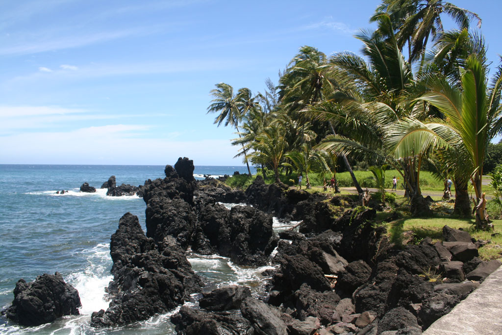
The Ke’anae shoreline is as rugged as it is picturesque.
Historically, Ke’anae has been a taro producing Hawaiian village, and much of the land is in taro lo’i today. It is told that the dirt was brought down here basket-by-basket. This story may very well be true since the area is young lava rock, created quite recently (geologically speaking) in a massive flow from Haleakala.
On April 1, 1946 the area was almost completely destroyed by a tsunami generated by an 8.6 magnitude earthquake off the coast of Alaska. Sadly this tiny low-lying village lost 20 children and four teachers to the massive 35′ waves. The only building left standing was the
Lanakila Ihiihi O Iehova O na Kaua Church (Sacredness, Success of Jehova, the Son of God.) This picturesque church was built in 1856, and is now known as the Ke’anae Congregational Church.
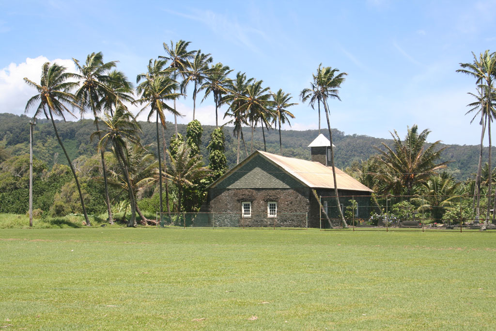
Keanae Congregational Church -or- Lanakila Ihiihi O Iehova O na Kaua
Aunty Sandy’s snack stand close to the church, well known in guidebooks for it’s banana bread, also has spectacular smoothies and coconut candy.
There is no sandy beach in Ka’anae, and the ocean is rugged and dangerous. Don’t try to go for a swim here.
Key Info:
Mile Marker: Via Keanae Peninsula Rd. @ #16.8 (Hana Hwy aka Hwy 360)
GPS Coordinates: 20.862782,-156.145806
Facilities: No facilities
Get directions
View Ke’anae Peninsula in a larger map
Jade B says:
First time I was at Ke’anae was amazed by the waves. 2nd time was a few years later. Had experienced a life change. I stepped out of a car and immediately tears fell. I felt like I was home. I felt peace. The spirituality of Ke’anae and all the islands is true meaning of Aloha.
Devastated about the loss of life and damages due to the fires.
My prayer for this beautiful place of beautiful people.
The Light of God Surrounds You…
Ka malamalama o Ke Akua e ho’opuni mai ia ‘oukou…
The Love of God Enfolds You…
Ke aloha o Ke Akua e kipuni mai ia ‘oukou…
The Power of God Protects You…
Ka mana o Ke Akua e ho’opakele mai ia ‘oukou…
The Presence of God Watches Over You…
Ke alo o Ke Akua e malama mai ia ‘oukou…
Wherever you are, GOD is!
Ma kahi a ‘oukou e hele aku ai he Akua no!
Amene.
Tom says:
We completed the Road to Hana about two weeks ago. I’m so pleased we did the entire loop — the scenery was breathtaking. Unfortunately, we missed Ke’anae.
Kiwi says:
We seldom drive all the way to Hana any more. We pack a lunch and beach chairs, drive to the end of the road in Keanae where we sit and watch the ocean. It’s so beautiful!
Erik says:
Aunt Sandy’s banana bread was worth the whole road to Hana trip.
Amanda Kraft says:
Absolutely agree about Aunty Sandy’s bread! We found it by accident but I am going back on my next trip in a few weeks. Heed the warning about dangerous water. My mom told me to stand on a rock for a photo and I forgot the old rule of never turning your back to the ocean. I was almost taken out by a rogue wave and spent the rest of the day wet. However, if you’ve never seen a lava rock “beach” this one is easy to get to and not crowded.
Also nearby was a guy selling coconut ice cream and “herbal remedies.”
Caro Takahashi says:
I can’t find any information on the population of Keanae. How many people live there right now in 2018? And who owns the loi being grown there?
Georgina Fourzan says:
I love this place worth the drive!